.jpg?gray=1&mw=180&hash=E8D2A897531FA5C8041284BF5B30BF0C)
From climate experts to political leaders there’s a growing consensus and recognition: our cities can no longer afford to be at war with nature. With extreme weather on the increase, we need to wean ourselves off an addiction to yet more concrete in the solutions we develop, in favour of more nature-based solutions to these threats.
In our recent report with the World Economic Forum, ‘BiodiverCities by 2030: Transforming Cities’ Relationship with Nature’, we showed that nature-based solutions are on average 50% more cost-effective than purely man-made alternatives, and deliver 28% more added value in both direct and environmental benefits. Helpfully, a combination of natural techniques and the very latest in digital technology and data analysis is proving the most effective approach.
Flooding threatens many cities and wherever you are in the world, it’s always a complex phenomenon to understand and predict. At Arup we’ve been using the power of machine-learning to engage with the challenge. We felt sure that the incredible analytical power of the technology could provide new ways to understand a particular city’s vulnerabilities, but also its natural ability to absorb excess rainfall and also how to enhance it.
Analysing the terrain
For those in charge, a huge issue is understanding how a city’s built and natural environment will cope with increasing and intensifying rainfall. You need to understand how and where the water will flow (or not) and how existing buildings and infrastructure contribute to the problem.
Terrain is a new tool we have developed to help planners and authorities understand how land is being used, in far greater detail than ever before. It uses data analytics, machine learning and automation to digest large quantities of data and satellite imagery, which can be open source or commercial. The tool’s analytical strength enables it to identify patterns, producing detailed land use maps. It also accurately calculates a region’s percentage coverage of different categories of land type, such as grass, trees, hard paved impervious land, buildings, and water.
This automates the traditionally time-consuming task of deciphering a city’s land use. Terrain five times faster than doing this analysis manually. It’s able to analyse 20,000m² of land data per second. Terrain can even distinguish between visually similar elements, such as a tree nursery and a forest. Users gain a highly detailed profile of the land use across their city.
From analysis to urban drainage masterplan
Terrain is already having an impact on our work. Greater Shanghai covers 640km² and has a population of 15 million – a figure that has tripled since 1990. As its impermeable concrete spaces have grown and green spaces decreased, stormwater runoff across the city has increased. On top of this, the existing drainage system was already challenged in its capacity, both in old and newly developed areas.
Shanghai’s risk of city flooding and river pollution was an urgent issue: the city needed advanced yet implementable strategies to deal with the issue.
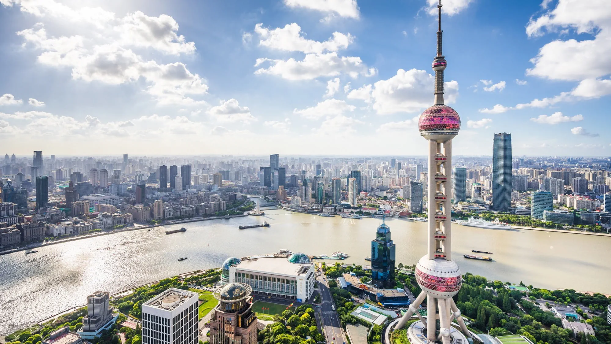
Arup won an international competition – organised by the Shanghai Water Authority – to provide a stormwater masterplan for the city. We used remote sensing data and employed our Terrain machine learning tool to interpret the images and categorise the entire area into 12 categories of flooding protection required.
This analysis, alongside a review of the previous drainage masterplan and a study of relevant cases across the globe, gave us the insight to devise a targeted water management approach. Instead of focusing solely on drainage, we proposed a visionary ‘blue, green and grey’ approach to support an integrated water cycle within the city.
Our urban flooding model also revealed valuable opportunities to embed ‘blue infrastructure’ elements like ponds, canals and waterways, into any solution. This was the first-ever model to integrate the river and drainage network in Shanghai.
From analysis to investment
This level of data analysis builds confidence that flood mitigations are worth the investment. Terrain was used to undertake a rapid assessment of the potential of different land uses in Mansfield, UK, to accommodate nature-based mitigations for surface water flood risks.
We then carried out a cost-benefit analysis of the different potential scenarios, including the assessment and valuation of wider benefits associated with the implementation of nature-based solutions. We calculated that an additional £6 million investment to establish a green wastewater management solution would result in wider benefits of more than £22 million. On top of improved resilience to floods, the benefits hit a variety of stakeholders: health benefits for its citizens due to changes in the living environment; increasing local government and business revenues because of stimulated local economic activity and upskilling in green economy jobs; and improved human health and happiness due to improved amenities.
Based on our analysis, the Office of Water Services in England and Wales allocated £75.7 million to Severn Trent to build sustainable green infrastructure and resilient communities in Mansfield.
Supporting the Tirana Orbital Forest
Find out how we’ve used Terrain to support development of Tirana’s proposed Orbital Forest – a new green ring around the perimeter of the city with a mix of forests, shrubland, agricultural land and recreational areas. Using Terrain, our analysis is helping the city secure essential financing for the project.
Rating cities' sponginess
Even before engaging with a specific project, digital tools can help assess cities’ preparedness for future risks. Arup’s Global Sponge Cities Snapshot is currently assessing the urban centres of seven major global cities’ natural ability to absorb water which can help to mitigate urban flooding, based on their green and blue spaces. These cities are New York, London, Singapore, Nairobi, Auckland, Mumbai, Shanghai.
Once again, this is achieved through Terrain’s analysis of satellite imagery, which is assessing the material make-up of approximately 150km² area of land in each city. From there, we can assess the city’s ‘sponginess’, by calculating how much land is pervious or impervious and then factoring in the individual cities’ soil characteristics.
Through an accurate analysis of their land use make-up, these cities are equipped with a representative baseline to evaluate and enhance their natural ‘sponginess’, together with a better understanding of how their existing natural assets contribute and could be further developed.
We’ve known for some time that natural water management solutions offer wider benefits than traditional engineered ‘grey’ solutions. Beyond stormwater management and flood mitigation, nature-based infrastructure can positively contribute to the resilience of a city and its people. Green and blue solutions help to improve air quality, promote biodiversity, and reduce the ‘urban heat island’ effect – they have a powerfully positive effect on quality of life.
We recognise that nature-based solutions and planning represents be a significant change of ethos for many leaders – and leaders may struggle to prioritise. Now, digital mapping can help ease that transition, leading to informed, faster decision-making around nature-based water management.