 ;
;
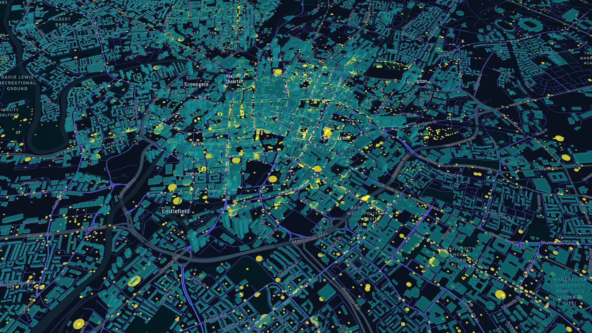
Cities are complex transport networks with many types of road users and pedestrians sharing the same congested routes. To facilitate more active travel, we need to better understand how pedestrians navigate their way to work, leisure, retail and other amenities. Only then can planners understand where the most attention is needed and where investment in active travel will add the greatest value. Arup developed the Staterra (formerly known as uMove) toolkit to examine urban network quality for active travel as perceived by its users, informing better active travel and placemaking decisions.
How it works
Staterra is an active travel analysis tool that automates the processing of hundreds of thousands of data points at a time, highlighting movement preference and route quality across our urban environments. The tool helps planners to understand:
-
People’s preferred or most appealing route (not the most direct)
-
The quality of roads and paths surrounding key points of interest (e.g., schools) Where relative demand and usage may be the highest
-
The dispersion of footfall near retail or leisure amenities
Staterra brings incredible speed to many formerly time-consuming processes, analysing hundreds of thousands of streets at once. Staterra also understands what makes active travel appealing, generating a composite score on quality that considers: distance, green space, elevation, land-use and traffic levels. With Staterra you can plan active travel schemes with data-driven techniques, enabling much larger coverage and a more comprehensive and unbiased approach.
Find out more
If you’d like to know more about Staterra and potential applications, please contact us, or visit our People Movement page