 ;
;
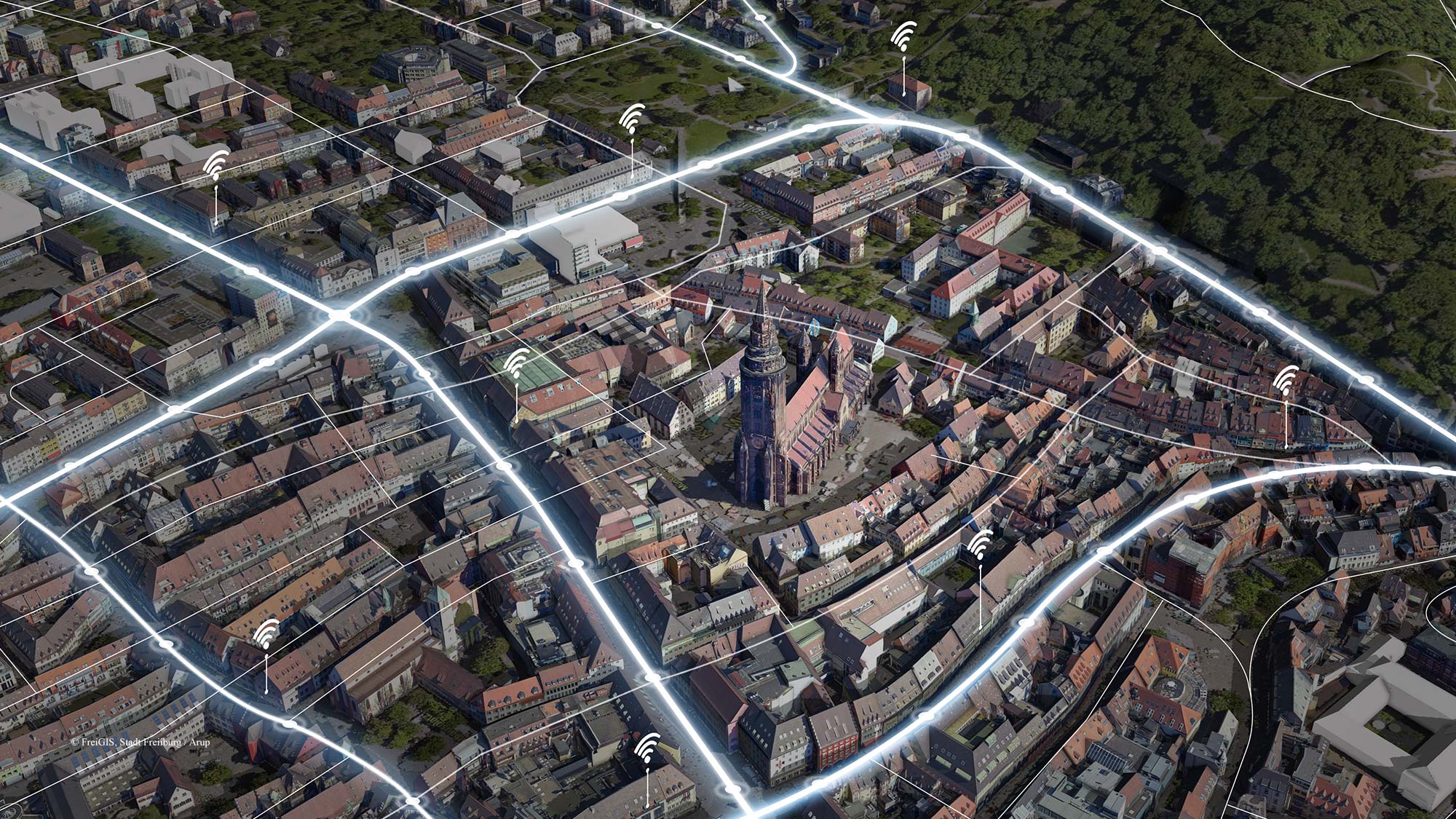
The digital transformation massively changes the way we live, work and interact with our towns and cities. As part of its digitalisation strategy, the German city of Freiburg im Breisgau is developing DATEN:RAUM:FREIBURG, a smart city model project. By collecting data from a multiple sources in a digital infrastructure, the project will analyse the data set and make it available to citizens and businesses, with the aim of improving the efficiency of city administration and urban development.
We developed a digital city twin for this project with two prototypes: an application with local mobility data to create a people-friendly traffic space and a digital sales platform for urban properties.
The role of traffic in the smart city
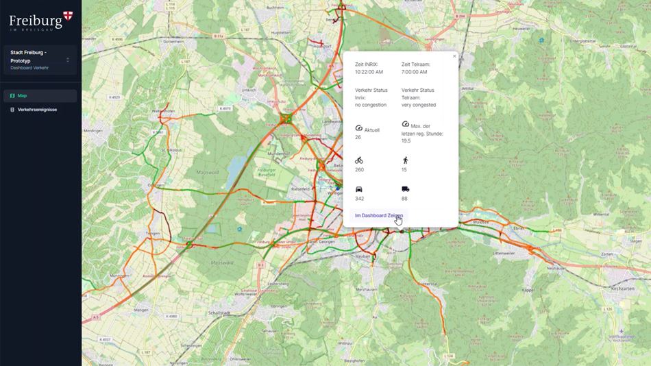
Traffic is common feature in almost every city. The solution we have developed for collecting live traffic data serves to ensure people-friendly traffic by means of optimised mobility control. It also aims to show the use of dynamic data from heterogeneous sources in an exemplary way.
In addition to cars, buses, and trucks, our application also records and analyses active mobility data, i.e., people walking and cycling, demographics that are often ignored in similar analyses. For the implementation, we use a crowdsource solution from the Belgian company Telraam. The sensors used by Telraam allow us to distinguish between drivers, cyclists and pedestrians. Thanks to the participation of citizens, who installed the camera device of the crowdsource platform on the inside of their windows, the necessary data could be collected. This solution conforms to data protection regulations, as the collected image data is processed directly on the devices and only count values are passed on.
A more efficient process
In the development of the sales platform for urban property management, the aim was to integrate, evaluate and ultimately visualise geodata and user data in the platform architecture. The new Dietenbach district of Freiburg, which will be home to thousands of people, was chosen as a case study. The digital preparation shows interactive three-dimensional maps with the available parcelling of the land as well as property-specific data.
An important component of the sales platform we developed is its transparency. If, for example, new construction plans exist for a local supply center and the first traders have been identified, then interested parties can check online whether their product range is a suitable addition for this location and, if necessary, even contact the traders. The process designed to be transparent in this way simplifies the award procedure and reduces the administrative workload enormously.
“DATEN:RAUM:FREIBURG will help us to tackle the complex challenges of the future. With the prototypes, we are taking a significant step forward in the smart city project. ” Martin Horn Mayor City of Freiburg im Breisgau
Platform architecture as the basis for further modules
The basic platform architecture consists of open source components. They have the advantage of avoiding dependence on a manufacturer, creating transparency through open source code, and enabling interoperability.
Interoperability in particular is vital to the project, as current and future extensions must be able to interact with different systems and programs and should not be limited to one technology. In addition, the platform architecture can be extended with semantic web technology to ensure "super search" in the future. Semantic web technologies not only link different information together, but also allow the content to be processed. A simple digital twin is not yet intelligent. Only through the use of knowledge graphs are the individual points integrated into a meaningful systematic structure. Knowledge graphs are data formats that collect and provide information. For the development of such a knowledge graph we cooperated with the technology company Computational Modelling Pirmasens (CMPG).
The modular design of the platform architecture ensures that further modules can be integrated into the existing structure without difficulty. Thus, it is possible to include any number of additional modules in the structure in the future, in addition to the "traffic data" and " property sales" modules.
“The overall goal of a smart city is to improve people's lives and achieve sustainability goals. The technology behind it is merely a tool. ”
Dr. Aurel von Richthofen Associate

Potentials of smart city development
With this project, we are demonstrating what is possible in the area of smart cities, particularly with regard to resource savings, emission reductions, optimised mobility and the reduction of administrative costs. Even if every city has to be planned individually, the project in Freiburg provides a possible blueprint that can be transferred to other cities because it is scalable and expandable - to the respective needs of the people.
Find out more about our digital twin expertise
Related
Projects